Bike, walk and transit directions
For getting around a city on a bike, on foot, on a train, or all three. Each route says why it goes the way it does: the busy streets it skips, the parks a walk goes through.
Free, with no account needed. In any browser, and on iPhone.
Routes that say what they skip
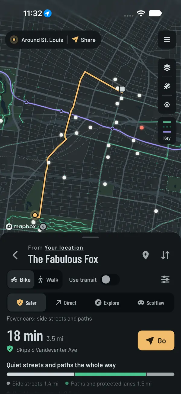
A bike trip comes in four kinds of route: Safer, Direct, Explore, and Scofflaw for people who know what they're doing. Each one says which busy streets it skips and which crossings it can't, with or without a light: "Skips S Vandeventer Ave", "Crosses Grand Blvd at a light". The busy stretches that are left are marked on the map.
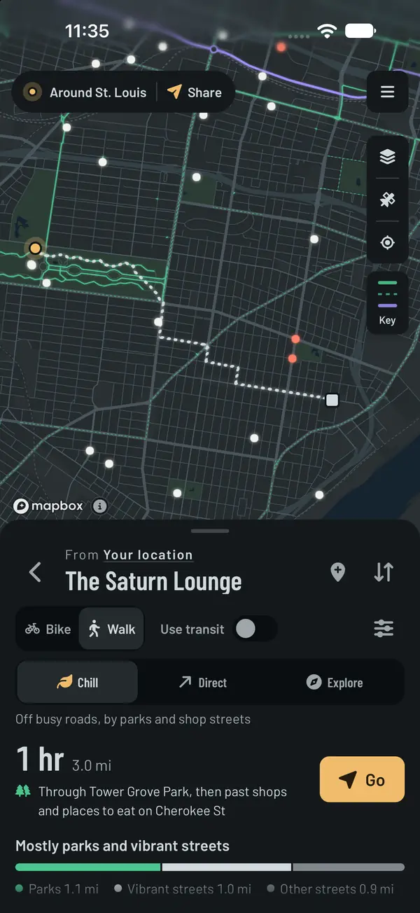
Walks say what they go through: the parks they cross, and the streets with places to eat, bars and shops along them. Explore says how much longer it is than the direct way.
Trains and buses
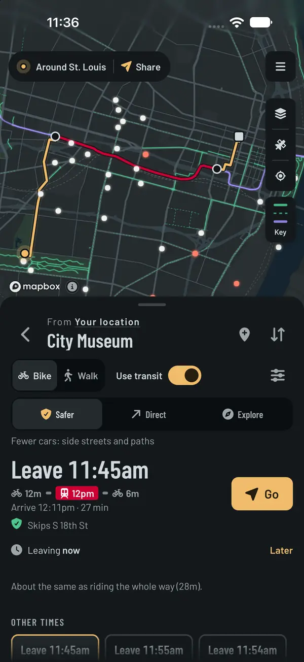
Trips can mix a bike ride or a walk with trains and buses, in most big cities: how long it takes and when you get there, then the departures to pick from, each with when to leave. Lines are in their own colors.
Share bike docks show how many bikes are there right now.
Turn by turn, or just the line
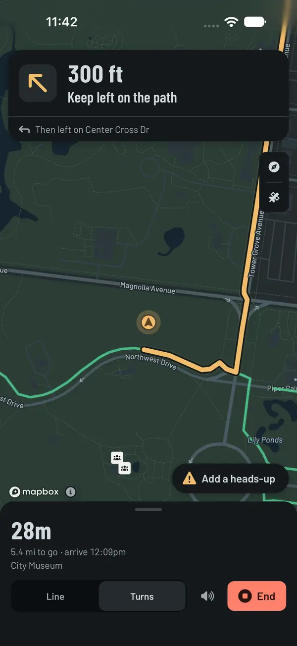
Navigation follows you on the map. Pick Turns for spoken directions, or Line to see the route and your dot and nothing else. Heads-ups from other people, like a pothole or a closed path, come up as you get close.
Draw your own routes
Tap or draw a line on the map and it follows real streets and paths. Add stops with notes and times, save it, and share it as a link.
Spots, landmarks and heads-ups
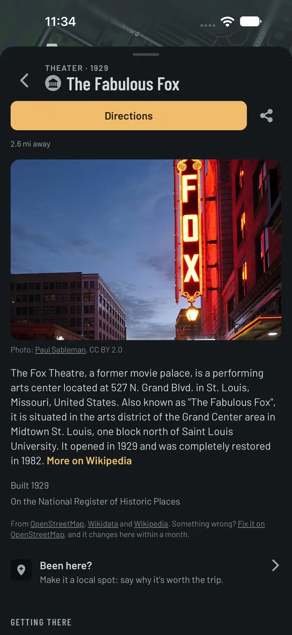
Places people have posted, and art, history and views from open map data, near you and along the way.
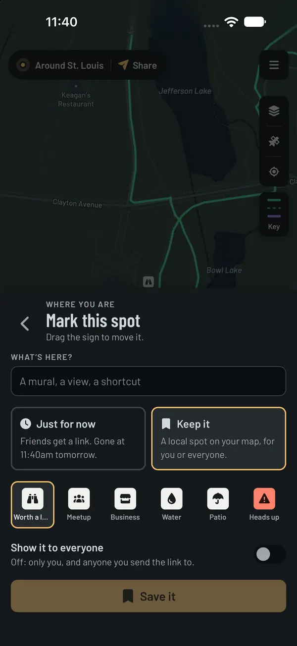
Mark a spot of your own: keep it on your map, show it to everyone, or send a friend a link to it for a day. Add a heads-up, like a pothole or a closed path, and it comes up for anyone navigating past it.
Share where you are
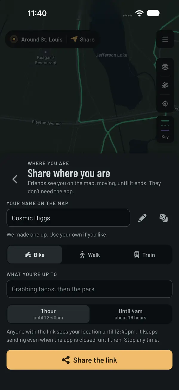
Send friends a link that shows you on the map, moving, for as long as you choose. They don't need the app. Stop any time.
The map
Bike lanes and paths, traffic lights and rail lines, with a key that says what each one means.
Overlays show which neighborhoods are lively, how steep each block is, which streets are lit at night, and how far you can get in 10, 20 or 30 minutes. Where you've been draws every street you've been down, from your own GPX files or your Strava history.

Questions
- Is it free?
- Yes. Everything for getting around is free. Supporters pay monthly or yearly to keep it running, and get a few extras as thanks: longer trips, driving directions, routes in colors of their own, more map looks, and the Rain, Hills and Wind overlays.
- Does it work in my city?
- Bike routes and walks work anywhere, from open map data, and transit trips in most big cities. It started in St. Louis, so that's where it's had the most use.
- Do I need an account?
- No. Plan, draw, save and share without one. Signing in keeps what you make with you on any device.
- Is there an Android app?
- It's in testing on Google Play, not open to everyone. On any Android phone, the app works in the browser.
- What happens to where I go?
- Your location stays on your phone unless you ask for something that needs it, and the app doesn't keep a record of where you go. No ads, and nothing is sold. The privacy page has the details.
- What if a route is wrong?
- Routes come from OpenStreetMap, which can be wrong. If something's off, report it from the route or the map.